Web Ecologist

Web Ecologist

Wednesday, 09 June 2021 13:37

Brackish water

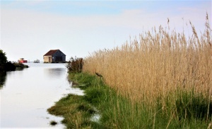
Brackish water, also sometimes termed brack water, is water occurring in a natural environment having more salinity than freshwater, but not as much as seawater. It may result from mixing seawater (salt water) with fresh water together, as in estuaries, or it may occur in brackish fossil aquifers. The word comes from the Middle Dutch root "brak". Certain human activities can produce brackish water, in particular civil engineering projects such as dikes and the flooding of coastal marshland to produce brackish water pools for freshwater prawn farming. Brackish water is also the primary waste product of the salinity gradient power process. Because brackish water is hostile to the growth of most terrestrial plant species, without appropriate management it is damaging to the environment.

Technically, brackish water contains between 0.5 and 30 grams of salt per litre—more often expressed as 0.5 to 30 parts per thousand (‰), which is a specific gravity of between 1.0004 and 1.0226. Thus, brackish covers a range of salinity regimes and is not considered a precisely defined condition. It is characteristic of many brackish surface waters that their salinity can vary considerably over space or time. Water with a salt concentration greater than 30‰ is considered saline.


Source: Wikipedia contributors. "Brackish water." Wikipedia, The Free Encyclopedia. Wikipedia, The Free Encyclopedia, 22 Mar. 2021. Web. 28 Jun. 2021.

Wednesday, 09 June 2021 13:37

Mudflat

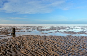
Mudflats or mud flats, also known as tidal flats, are coastal wetlands that form in intertidal areas where sediments have been deposited by tides or rivers. A recent global analysis suggested they are as extensive globally as mangroves. They are found in sheltered areas such as bays, bayous, lagoons, and estuaries; they are also seen in freshwater lakes and salty lakes (or inland seas) alike, wherein many rivers and creeks end. Mudflats may be viewed geologically as exposed layers of bay mud, resulting from deposition of estuarine silts, clays and aquatic animal detritus. Most of the sediment within a mudflat is within the intertidal zone, and thus the flat is submerged and exposed approximately twice daily.

In the past tidal flats were considered unhealthy, economically unimportant areas and were often dredged and developed into agricultural land. Several especially shallow mudflat areas, such as the Wadden Sea, are now popular among those practising the sport of mudflat hiking.

On the Baltic Sea coast of Germany in places, mudflats are exposed not by tidal action, but by wind-action driving water away from the shallows into the sea. These wind-affected mudflats are called windwatts in German.

Ecology

Tidal flats, along with intertidal salt marshes and mangrove forests, are important ecosystems. They usually support a large population of wildlife, and are a key habitat that allows tens of millions of migratory shorebirds to migrate from breeding sites in the northern hemisphere to non-breeding areas in the southern hemisphere. They are often of vital importance to migratory birds, as well as certain species of crabs, mollusks and fish. In the United Kingdom mudflats have been classified as a Biodiversity Action Plan priority habitat.

The maintenance of mudflats is important in preventing coastal erosion. However, mudflats worldwide are under threat from predicted sea level rises, land claims for development, dredging due to shipping purposes, and chemical pollution. In some parts of the world, such as East and South-East Asia, mudflats have been reclaimed for aquaculture, agriculture, and industrial development. For example, around the Yellow Sea region of East Asia, more than 65% of mudflats present in the early 1950s had been destroyed by the late 2000s. It is estimated that up to 16% of the world tidal flats have disappeared since the mid-1980s.

Mudflat sediment deposits are focused into the intertidal zone which is composed of a barren zone and marshes. Within these areas are various ratios of sand and mud that make up the sedimentary layers. The associated growth of coastal sediment deposits can be attributed to rates of subsidence along with rates of deposition (example: silt transported via river) and changes in sea level.

Barren zones extend from the lowest portion of the intertidal zone to the marsh areas. Beginning in close proximity to the tidal bars, sand dominated layers are prominent and become increasingly muddy throughout the tidal channels. Common bedding types include laminated sand, ripple bedding, and bay mud. Bioturbation also has a strong presence in barren zones.

Marshes contain an abundance of herbaceous plants while the sediment layers consist of thin sand and mud layers. Mudcracks are a common as well as wavy bedding planes. Marshes are also the origins of coal/peat layers because of the abundant decaying plant life.

Salt pans can be distinguished in that they contain thinly laminated layers of clayey silt. The main source of the silt comes from rivers. Dried up mud along with wind erosion forms silt dunes. When flooding, rain or tides come in, the dried sediment is then re-distributed.


Source: Wikipedia contributors. "Mudflat." Wikipedia, The Free Encyclopedia. Wikipedia, The Free Encyclopedia, 18 Apr. 2021. Web. 28 Jun. 2021.
Wednesday, 09 June 2021 13:37

Rocky coast

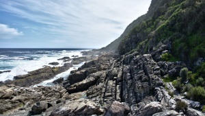
The coast, also known as the coastline or seashore, is defined as the area where land meets the sea or ocean, or as a line that forms the boundary between the land and the ocean or a lake. Earth has around 620,000 kilometres (390,000 mi) of coastline. Because coasts are constantly changing, a coastline's exact perimeter cannot be determined; this measurement challenge is called the coastline paradox. The term coastal zone is used to refer to a region where interactions of sea and land processes occur. Both the terms coast and coastal are often used to describe a geographic location or region located on a coastline (e.g., New Zealand's West Coast, or the East, West, and Gulf Coast of the United States.)

Coasts are important zones in natural ecosystems, often home to a wide range of biodiversity, and important zones such as wetlands which are important for bird populations or mangroves or seagrass which provide nursery habitat for fish or other aquatic species. Some coasts fronts on the open ocean and are called pelagic coast while other coasts are more sheltered coast in a gulf or bay. A shore, on the other hand, may refer to parts of land adjoining any large body of water, including oceans (seashore) and lakes (lake shore).

Wikipedia contributors. "Coast." Wikipedia, The Free Encyclopedia. Wikipedia, The Free Encyclopedia, 17 Jun. 2021. Web. 28 Jun. 2021.

Wednesday, 09 June 2021 13:36

Sandy coast

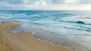
The coast, also known as the coastline or seashore, is defined as the area where land meets the sea or ocean, or as a line that forms the boundary between the land and the ocean or a lake. Earth has around 620,000 kilometres (390,000 mi) of coastline. Because coasts are constantly changing, a coastline's exact perimeter cannot be determined; this measurement challenge is called the coastline paradox. The term coastal zone is used to refer to a region where interactions of sea and land processes occur. Both the terms coast and coastal are often used to describe a geographic location or region located on a coastline (e.g., New Zealand's West Coast, or the East, West, and Gulf Coast of the United States.)

Coasts are important zones in natural ecosystems, often home to a wide range of biodiversity, and important zones such as wetlands which are important for bird populations or mangroves or seagrass which provide nursery habitat for fish or other aquatic species. Some coasts fronts on the open ocean and are called pelagic coast while other coasts are more sheltered coast in a gulf or bay. A shore, on the other hand, may refer to parts of land adjoining any large body of water, including oceans (seashore) and lakes (lake shore).

Source: Wikipedia contributors. "Coast." Wikipedia, The Free Encyclopedia. Wikipedia, The Free Encyclopedia, 17 Jun. 2021. Web. 28 Jun. 2021.

Wednesday, 09 June 2021 13:36

Artificial freshwater

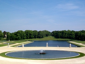
 A basin is an artificially created water basin. It is used, among other things, in geometric garden art because, in contrast to the artificial lake, it consists only of basic geometric shapes (e.g.: rectangle, circle, ellipse) or their combination (e.g.: rectangle with attached semicircle). In animal husbandry/zoo, large water pools are also referred to as basins.

Quelle: Seite „Bassin“. In: Wikipedia – Die freie Enzyklopädie. Bearbeitungsstand: 1. Juli 2020, 17:31 UTC. URL: https://de.wikipedia.org/w/index.php?title=Bassin&oldid=201482136 (Abgerufen: 13. September 2021, 18:33 UTC)

Wednesday, 09 June 2021 13:36

Bog

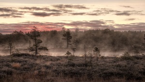
A bog or bogland is a wetland that accumulates peat, a deposit of dead plant material—often mosses, and in a majority of cases, sphagnum moss. It is one of the four main types of wetlands. Other names for bogs include mire, mosses, quagmire, and muskeg; alkaline mires are called fens.[clarification needed] A baygall is another type of bog found in the forest of the Gulf Coast states in the United States. They are often covered in heath or heather shrubs rooted in the sphagnum moss and peat. The gradual accumulation of decayed plant material in a bog functions as a carbon sink.

Bogs occur where the water at the ground surface is acidic and low in nutrients.[clarification needed] In contrast to fens, they derive most of their water from precipitation rather than mineral-rich ground or surface water. Water flowing out of bogs has a characteristic brown colour, which comes from dissolved peat tannins. In general, the low fertility and cool climate result in relatively slow plant growth, but decay is even slower due to low oxygen levels in saturated bog soils. Hence, peat accumulates. Large areas of the landscape can be covered many meters deep in peat.

Bogs have distinctive assemblages of animal, fungal and plant species, and are of high importance for biodiversity, particularly in landscapes that are otherwise settled and farmed.


Source: Wikipedia contributors. "Bog." Wikipedia, The Free Encyclopedia. Wikipedia, The Free Encyclopedia, 6 Jun. 2021. Web. 28 Jun. 2021.

Wednesday, 09 June 2021 13:35

Swamp

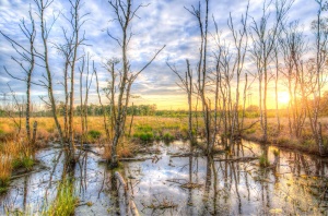
A swamp is a forested wetland. Swamps are considered to be transition zones because both land and water play a role in creating this environment. Swamps vary in size and are located all around the world. The water of a swamp may be fresh water, brackish water, or seawater. Freshwater swamps form along large rivers or lakes where they are critically dependent upon rainwater and seasonal flooding to maintain natural water level fluctuations. Saltwater swamps are found along tropical and subtropical coastlines. Some swamps have hammocks, or dry-land protrusions, covered by aquatic vegetation, or vegetation that tolerates periodic inundation or soil saturation. The two main types of swamp are "true" or swamp forests and "transitional" or shrub swamps. In the boreal regions of Canada, the word swamp is colloquially used for what is more correctly termed a bog, fen, or muskeg. Some of the world's largest swamps are found along major rivers such as the Amazon, the Mississippi, and the Congo.


Source: Wikipedia contributors. "Swamp." Wikipedia, The Free Encyclopedia. Wikipedia, The Free Encyclopedia, 24 Jun. 2021. Web. 28 Jun. 2021.

Wednesday, 09 June 2021 13:35

Riparian zone

A riparian zone or riparian area is the interface between land and a river or stream. Riparian is also the proper nomenclature for one of the terrestrial biomes of the Earth. Plant habitats and communities along the river margins and banks are called riparian vegetation, characterized by hydrophilic plants. Riparian zones are important in ecology, environmental resource management, and civil engineering because of their role in soil conservation, their habitat biodiversity, and the influence they have on fauna and aquatic ecosystems, including grasslands, woodlands, wetlands, or even non-vegetative areas. In some regions, the terms riparian woodland, riparian forest, riparian buffer zone, riparian corridor, and riparian strip are used to characterize a riparian zone. The word riparian is derived from Latin ripa, meaning "river bank".

Characteristics

Riparian zones may be natural or engineered for soil stabilization or restoration. These zones are important natural biofilters, protecting aquatic environments from excessive sedimentation, polluted surface runoff, and erosion. They supply shelter and food for many aquatic animals and shade that limits stream temperature change. When riparian zones are damaged by construction, agriculture or silviculture, biological restoration can take place, usually by human intervention in erosion control and revegetation. If the area adjacent to a watercourse has standing water or saturated soil for as long as a season, it is normally termed a wetland because of its hydric soil characteristics. Because of their prominent role in supporting a diversity of species, riparian zones are often the subject of national protection in a biodiversity action plan. These are also known as a "plant or vegetation waste buffer".

Research shows that riparian zones are instrumental in water quality improvement for both surface runoff and water flowing into streams through subsurface or groundwater flow. Riparian zones can play a role in lowering nitrate contamination in surface runoff, such as manure and other fertilizers from agricultural fields, that would otherwise damage ecosystems and human health. Particularly, the attenuation of nitrate or denitrification of the nitrates from fertilizer in this buffer zone is important. The use of wetland riparian zones shows a particularly high rate of removal of nitrate entering a stream and thus has a place in agricultural management. Also in terms of carbon transport from terrestrial ecosystems to aquatic ecosystems, riparian groundwater can play an important role. As such, a distinction can be made between parts of the riparian zone that connect large parts of the landscape to streams, and riparian areas with more local groundwater contributions.


Source: Wikipedia contributors. "Riparian zone." Wikipedia, The Free Encyclopedia. Wikipedia, The Free Encyclopedia, 12 Jun. 2021. Web. 28 Jun. 2021.

Wednesday, 09 June 2021 13:35

River

A river is a natural flowing watercourse, usually freshwater, flowing towards an ocean, sea, lake or another river. In some cases, a river flows into the ground and becomes dry at the end of its course without reaching another body of water. Small rivers can be referred to using names such as stream, creek, brook, rivulet, and rill. There are no official definitions for the generic term river as applied to geographic features, although in some countries or communities a stream is defined by its size. Many names for small rivers are specific to geographic location; examples are "run" in some parts of the United States, "burn" in Scotland and northeast England, and "beck" in northern England. Sometimes a river is defined as being larger than a creek, but not always: the language is vague.

Melting toe of Athabasca Glacier, Jasper National Park, Alberta, Canada
Rivers are part of the hydrological cycle. Water generally collects in a river from precipitation through a drainage basin from surface runoff and other sources such as groundwater recharge, springs, and the release of stored water in natural ice and snowpacks (e.g., from glaciers).

Rivers and streams are often considered major features within a landscape; however, they actually only cover around 0.1% of the land on Earth. They are made more obvious and significant to humans by the fact that many human cities and civilizations are built around the freshwater supplied by rivers and streams.Most of the major cities of the world are situated on the banks of rivers, as they are, or were, used as a source of water, for obtaining food, for transport, as borders, as a defensive measure, as a source of hydropower to drive machinery, for bathing, and as a means of disposing of waste.

Potamology is the scientific study of rivers, while limnology is the study of inland waters in general.


Source: Wikipedia contributors. "River." Wikipedia, The Free Encyclopedia. Wikipedia, The Free Encyclopedia, 8 Jun. 2021. Web. 28 Jun. 2021.

Wednesday, 09 June 2021 13:35

Stream

A stream is a body of water with surface water flowing within the bed and banks of a channel. The flow of a stream is controlled by three inputs – surface water, subsurface water and groundwater. The surface and subsurface water are highly variable between periods of rainfall. Groundwater, on the other hand, has a relatively constant input and is controlled more by long-term patterns of precipitation. The stream encompasses surface, subsurface and groundwater fluxes that respond to geological, geomorphological, hydrological and biotic controls.

Depending on its location or certain characteristics, a stream may be referred to by a variety of local or regional names. Long large streams are usually called rivers.

Streams are important as conduits in the water cycle, instruments in groundwater recharge, and corridors for fish and wildlife migration. The biological habitat in the immediate vicinity of a stream is called a riparian zone. Given the status of the ongoing Holocene extinction, streams play an important corridor role in connecting fragmented habitats and thus in conserving biodiversity. The study of streams and waterways in general is known as surface hydrology and is a core element of environmental geography.


Source: Wikipedia contributors. "Stream." Wikipedia, The Free Encyclopedia. Wikipedia, The Free Encyclopedia, 3 Jun. 2021. Web. 28 Jun. 2021.


Page 2597 of 3233

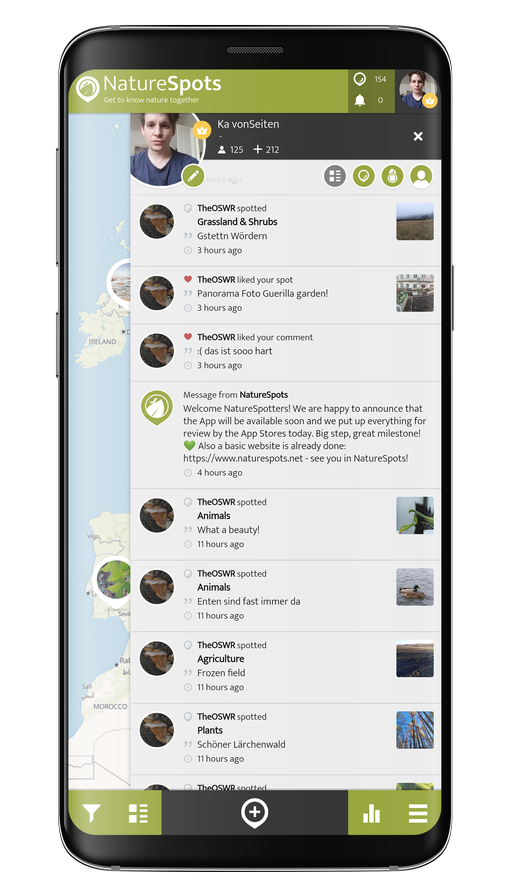
NatureSpots NSP AppScreens 06 S9 Trans

Hey, do you love Nature?

Observing and learning about nature is fun and can help to protect our environment. In the NatureSpots App, you can put up all kinds of nature sightings - from species to habitats. Join up and help to build a biodiversity data set and share your photos!

JOIN THE COMMUNITY

Create your account or download the NatureSpots App for your Smartphone now to join the community!

NatureSpots App with plants and leaves

Get the free App!

NatureSpots is a non-profit and 100% community-driven project. We run it because we love to discover our world and share our findings with others. The app does not contain any ads and we do not get money from this project at all. Download the App on your Smartphone and join up!

Android AppStoreBadge 150x45px IOS AppStoreBadge 150x45px

Want to partner up for a new biodiversity experience?

We are looking for partners, who are interested in biodiversity data, Citizen Science and being part of a modern and unique app. NatureSpots App is running on the SPOTTERON Citizen Science platform and provides a wide range of interactive features. For partners, we can provide communication tools, access to the data administration interface and download of occurrence records without any costs.

Please get in contact via office@spotteron.net if you are interested in joining NatureSpots with your organization! Let's talk about the future of biodiversity monitoring and how we can work best together!