Web Ecologist

Web Ecologist

Wednesday, 09 June 2021 13:38

Oceanic island

Oceanic islands are islands that do not sit on continental shelves. The vast majority are volcanic in origin, such as Saint Helena in the South Atlantic Ocean. The few oceanic islands that are not volcanic are tectonic in origin and arise where plate movements have lifted up the ocean floor above the surface. Examples are Saint Peter and Paul Rocks in the Atlantic Ocean and Macquarie Island in the Pacific.

Arcs
One type of volcanic oceanic island is found in a volcanic island arc. These islands arise from volcanoes where the subduction of one plate under another is occurring. Examples are the Aleutian Islands, the Mariana Islands, and most of Tonga in the Pacific Ocean. The only examples in the Atlantic Ocean are some of the Lesser Antilles and the South Sandwich Islands.

Oceanic Rifts
Another type of volcanic oceanic island occurs where an oceanic rift reaches the surface. There are two examples: Iceland, which is the world's second largest volcanic island, and Jan Mayen. Both are in the Atlantic.

Hotspots
A third type of volcanic oceanic island is formed over volcanic hotspots. A hotspot is more or less stationary relative to the moving tectonic plate above it, so a chain of islands results as the plate drifts. Over long periods of time, this type of island is eventually "drowned" by isostatic adjustment and eroded, becoming a seamount. Plate movement across a hot-spot produces a line of islands oriented in the direction of the plate movement. An example is the Hawaiian Islands, from Hawaii to Kure, which continue beneath the sea surface in a more northerly direction as the Emperor Seamounts. Another chain with similar orientation is the Tuamotu Archipelago; its older, northerly trend is the Line Islands. The southernmost chain is the Austral Islands, with its northerly trending part the atolls in the nation of Tuvalu. Tristan da Cunha is an example of a hotspot volcano in the Atlantic Ocean. Another hotspot in the Atlantic is the island of Surtsey, which was formed in 1963.

Atolls
An atoll is an island formed from a coral reef that has grown on an eroded and submerged volcanic island. The reef rises to the surface of the water and forms a new island. Atolls are typically ring-shaped with a central lagoon. Examples are the Line Islands in the Pacific and the Maldives in the Indian Ocean.

Source: Wikipedia contributors. "Island." Wikipedia, The Free Encyclopedia. Wikipedia, The Free Encyclopedia, 30 May. 2021. Web. 28 Jun. 2021.

Wednesday, 09 June 2021 13:38

Coral reef

A coral reef is an underwater ecosystem characterized by reef-building corals. Reefs are formed of colonies of coral polyps held together by calcium carbonate. Most coral reefs are built from stony corals, whose polyps cluster in groups.

Coral belongs to the class Anthozoa in the animal phylum Cnidaria, which includes sea anemones and jellyfish. Unlike sea anemones, corals secrete hard carbonate exoskeletons that support and protect the coral. Most reefs grow best in warm, shallow, clear, sunny and agitated water. Coral reefs first appeared 485 million years ago, at the dawn of the Early Ordovician, displacing the microbial and sponge reefs of the Cambrian.

Sometimes called rainforests of the sea, shallow coral reefs form some of Earth's most diverse ecosystems. They occupy less than 0.1% of the world's ocean area, about half the area of France, yet they provide a home for at least 25% of all marine species, including fish, mollusks, worms, crustaceans, echinoderms, sponges, tunicates and other cnidarians. Coral reefs flourish in ocean waters that provide few nutrients. They are most commonly found at shallow depths in tropical waters, but deep water and cold water coral reefs exist on smaller scales in other areas.

Coral reefs deliver ecosystem services for tourism, fisheries and shoreline protection. Coral reefs are fragile, partly because they are sensitive to water conditions. They are under threat from excess nutrients (nitrogen and phosphorus), rising temperatures, oceanic acidification, overfishing (e.g., from blast fishing, cyanide fishing, spearfishing on scuba), sunscreen use, and harmful land-use practices, including runoff and seeps (e.g., from injection wells and cesspools).

Source: Wikipedia contributors. "Coral reef." Wikipedia, The Free Encyclopedia. Wikipedia, The Free Encyclopedia, 27 Jun. 2021. Web. 28 Jun. 2021.

Wednesday, 09 June 2021 13:38

Open water

The sea, connected as the world ocean or simply the ocean, is the body of salty water that covers over 70 percent of the Earth's surface. The word sea is also used to denote second-order sections of the sea, such as the Mediterranean Sea, as well as certain large, entirely landlocked, saltwater lakes, such as the Caspian Sea.

The sea moderates Earth's climate and has important roles in the water cycle, carbon cycle, and nitrogen cycle. Humans harnessing and studying the sea have been recorded since ancient times, and evidenced well into prehistory, while its modern scientific study is called oceanography. The most abundant solid dissolved in seawater is sodium chloride. The water also contains salts of magnesium, calcium, potassium, and mercury, amongst many other elements, some in minute concentrations. Salinity varies widely, being lower near the surface and the mouths of large rivers and higher in the depths of the ocean; however, the relative proportions of dissolved salts vary little across the oceans. Winds blowing over the surface of the sea produce waves, which break when they enter the shallow water. Winds also create surface currents through friction, setting up slow but stable circulations of water throughout the oceans. The directions of the circulation are governed by factors, including the shapes of the continents and Earth's rotation (the Coriolis effect). Deep-sea currents, known as the global conveyor belt, carry cold water from near the poles to every ocean. Tides, the generally twice-daily rise and fall of sea levels, are caused by Earth's rotation and the gravitational effects of the orbiting Moon and, to a lesser extent, of the Sun. Tides may have a very high range in bays or estuaries. Submarine earthquakes arising from tectonic plate movements under the oceans can lead to destructive tsunamis, as can volcanoes, huge landslides, or the impact of large meteorites.

A wide variety of organisms, including bacteria, protists, algae, plants, fungi, and animals, live in the sea, which offers a wide range of marine habitats and ecosystems, ranging vertically from the sunlit surface and shoreline to the great depths and pressures of the cold, dark abyssal zone, and in latitude from the cold waters under polar ice caps to the colourful diversity of coral reefs in tropical regions. Many of the major groups of organisms evolved in the sea and life may have started there.

The sea provides substantial supplies of food for humans, mainly fish, but also shellfish, mammals and seaweed, whether caught by fishermen or farmed underwater. Other human uses of the sea include trade, travel, mineral extraction, power generation, warfare, and leisure activities such as swimming, sailing, and scuba diving. Many of these activities create marine pollution. The sea has therefore been for humans an integral element throughout history and culture.


Source: Wikipedia contributors. "Sea." Wikipedia, The Free Encyclopedia. Wikipedia, The Free Encyclopedia, 22 Jun. 2021. Web. 28 Jun. 2021.

Wednesday, 09 June 2021 13:38

Shelf region

A continental shelf is a portion of a continent that is submerged under an area of relatively shallow water known as a shelf sea. Much of these shelves were exposed by drops in sea level during glacial periods. The shelf surrounding an island is known as an insular shelf.

The continental margin, between the continental shelf and the abyssal plain, comprises a steep continental slope, surrounded by the flatter continental rise, in which sediment from the continent above cascades down the slope and accumulates as a pile of sediment at the base of the slope. Extending as far as 500 km (310 mi) from the slope, it consists of thick sediments deposited by turbidity currents from the shelf and slope. The continental rise's gradient is intermediate between the gradients of the slope and the shelf.

Under the United Nations Convention on the Law of the Sea, the name continental shelf was given a legal definition as the stretch of the seabed adjacent to the shores of a particular country to which it belongs.

Source: Wikipedia contributors. "Continental shelf." Wikipedia, The Free Encyclopedia. Wikipedia, The Free Encyclopedia, 20 Jun. 2021. Web. 28 Jun. 2021.

Wednesday, 09 June 2021 13:37

Brackish water

Brackish water, also sometimes termed brack water, is water occurring in a natural environment having more salinity than freshwater, but not as much as seawater. It may result from mixing seawater (salt water) with fresh water together, as in estuaries, or it may occur in brackish fossil aquifers. The word comes from the Middle Dutch root "brak". Certain human activities can produce brackish water, in particular civil engineering projects such as dikes and the flooding of coastal marshland to produce brackish water pools for freshwater prawn farming. Brackish water is also the primary waste product of the salinity gradient power process. Because brackish water is hostile to the growth of most terrestrial plant species, without appropriate management it is damaging to the environment.

Technically, brackish water contains between 0.5 and 30 grams of salt per litre—more often expressed as 0.5 to 30 parts per thousand (‰), which is a specific gravity of between 1.0004 and 1.0226. Thus, brackish covers a range of salinity regimes and is not considered a precisely defined condition. It is characteristic of many brackish surface waters that their salinity can vary considerably over space or time. Water with a salt concentration greater than 30‰ is considered saline.


Source: Wikipedia contributors. "Brackish water." Wikipedia, The Free Encyclopedia. Wikipedia, The Free Encyclopedia, 22 Mar. 2021. Web. 28 Jun. 2021.

Wednesday, 09 June 2021 13:37

Mudflat

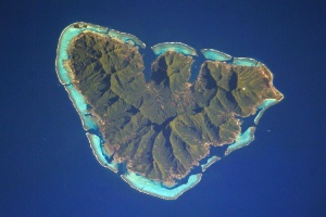
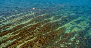
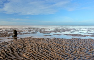
Mudflats or mud flats, also known as tidal flats, are coastal wetlands that form in intertidal areas where sediments have been deposited by tides or rivers. A recent global analysis suggested they are as extensive globally as mangroves. They are found in sheltered areas such as bays, bayous, lagoons, and estuaries; they are also seen in freshwater lakes and salty lakes (or inland seas) alike, wherein many rivers and creeks end. Mudflats may be viewed geologically as exposed layers of bay mud, resulting from deposition of estuarine silts, clays and aquatic animal detritus. Most of the sediment within a mudflat is within the intertidal zone, and thus the flat is submerged and exposed approximately twice daily.

In the past tidal flats were considered unhealthy, economically unimportant areas and were often dredged and developed into agricultural land. Several especially shallow mudflat areas, such as the Wadden Sea, are now popular among those practising the sport of mudflat hiking.

On the Baltic Sea coast of Germany in places, mudflats are exposed not by tidal action, but by wind-action driving water away from the shallows into the sea. These wind-affected mudflats are called windwatts in German.

Ecology

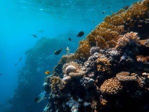
Tidal flats, along with intertidal salt marshes and mangrove forests, are important ecosystems. They usually support a large population of wildlife, and are a key habitat that allows tens of millions of migratory shorebirds to migrate from breeding sites in the northern hemisphere to non-breeding areas in the southern hemisphere. They are often of vital importance to migratory birds, as well as certain species of crabs, mollusks and fish. In the United Kingdom mudflats have been classified as a Biodiversity Action Plan priority habitat.

The maintenance of mudflats is important in preventing coastal erosion. However, mudflats worldwide are under threat from predicted sea level rises, land claims for development, dredging due to shipping purposes, and chemical pollution. In some parts of the world, such as East and South-East Asia, mudflats have been reclaimed for aquaculture, agriculture, and industrial development. For example, around the Yellow Sea region of East Asia, more than 65% of mudflats present in the early 1950s had been destroyed by the late 2000s. It is estimated that up to 16% of the world tidal flats have disappeared since the mid-1980s.

Mudflat sediment deposits are focused into the intertidal zone which is composed of a barren zone and marshes. Within these areas are various ratios of sand and mud that make up the sedimentary layers. The associated growth of coastal sediment deposits can be attributed to rates of subsidence along with rates of deposition (example: silt transported via river) and changes in sea level.

Barren zones extend from the lowest portion of the intertidal zone to the marsh areas. Beginning in close proximity to the tidal bars, sand dominated layers are prominent and become increasingly muddy throughout the tidal channels. Common bedding types include laminated sand, ripple bedding, and bay mud. Bioturbation also has a strong presence in barren zones.

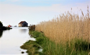
Marshes contain an abundance of herbaceous plants while the sediment layers consist of thin sand and mud layers. Mudcracks are a common as well as wavy bedding planes. Marshes are also the origins of coal/peat layers because of the abundant decaying plant life.

Salt pans can be distinguished in that they contain thinly laminated layers of clayey silt. The main source of the silt comes from rivers. Dried up mud along with wind erosion forms silt dunes. When flooding, rain or tides come in, the dried sediment is then re-distributed.


Source: Wikipedia contributors. "Mudflat." Wikipedia, The Free Encyclopedia. Wikipedia, The Free Encyclopedia, 18 Apr. 2021. Web. 28 Jun. 2021.

Wednesday, 09 June 2021 13:37

Rocky coast

The coast, also known as the coastline or seashore, is defined as the area where land meets the sea or ocean, or as a line that forms the boundary between the land and the ocean or a lake. Earth has around 620,000 kilometres (390,000 mi) of coastline. Because coasts are constantly changing, a coastline's exact perimeter cannot be determined; this measurement challenge is called the coastline paradox. The term coastal zone is used to refer to a region where interactions of sea and land processes occur. Both the terms coast and coastal are often used to describe a geographic location or region located on a coastline (e.g., New Zealand's West Coast, or the East, West, and Gulf Coast of the United States.)

Coasts are important zones in natural ecosystems, often home to a wide range of biodiversity, and important zones such as wetlands which are important for bird populations or mangroves or seagrass which provide nursery habitat for fish or other aquatic species. Some coasts fronts on the open ocean and are called pelagic coast while other coasts are more sheltered coast in a gulf or bay. A shore, on the other hand, may refer to parts of land adjoining any large body of water, including oceans (seashore) and lakes (lake shore).

Wikipedia contributors. "Coast." Wikipedia, The Free Encyclopedia. Wikipedia, The Free Encyclopedia, 17 Jun. 2021. Web. 28 Jun. 2021.

Wednesday, 09 June 2021 13:36

Sandy coast

The coast, also known as the coastline or seashore, is defined as the area where land meets the sea or ocean, or as a line that forms the boundary between the land and the ocean or a lake. Earth has around 620,000 kilometres (390,000 mi) of coastline. Because coasts are constantly changing, a coastline's exact perimeter cannot be determined; this measurement challenge is called the coastline paradox. The term coastal zone is used to refer to a region where interactions of sea and land processes occur. Both the terms coast and coastal are often used to describe a geographic location or region located on a coastline (e.g., New Zealand's West Coast, or the East, West, and Gulf Coast of the United States.)

Coasts are important zones in natural ecosystems, often home to a wide range of biodiversity, and important zones such as wetlands which are important for bird populations or mangroves or seagrass which provide nursery habitat for fish or other aquatic species. Some coasts fronts on the open ocean and are called pelagic coast while other coasts are more sheltered coast in a gulf or bay. A shore, on the other hand, may refer to parts of land adjoining any large body of water, including oceans (seashore) and lakes (lake shore).

Source: Wikipedia contributors. "Coast." Wikipedia, The Free Encyclopedia. Wikipedia, The Free Encyclopedia, 17 Jun. 2021. Web. 28 Jun. 2021.

Wednesday, 09 June 2021 13:36

Artificial freshwater

 A basin is an artificially created water basin. It is used, among other things, in geometric garden art because, in contrast to the artificial lake, it consists only of basic geometric shapes (e.g.: rectangle, circle, ellipse) or their combination (e.g.: rectangle with attached semicircle). In animal husbandry/zoo, large water pools are also referred to as basins.

Quelle: Seite „Bassin“. In: Wikipedia – Die freie Enzyklopädie. Bearbeitungsstand: 1. Juli 2020, 17:31 UTC. URL: https://de.wikipedia.org/w/index.php?title=Bassin&oldid=201482136 (Abgerufen: 13. September 2021, 18:33 UTC)

Wednesday, 09 June 2021 13:36

Bog

A bog or bogland is a wetland that accumulates peat, a deposit of dead plant material—often mosses, and in a majority of cases, sphagnum moss. It is one of the four main types of wetlands. Other names for bogs include mire, mosses, quagmire, and muskeg; alkaline mires are called fens.[clarification needed] A baygall is another type of bog found in the forest of the Gulf Coast states in the United States. They are often covered in heath or heather shrubs rooted in the sphagnum moss and peat. The gradual accumulation of decayed plant material in a bog functions as a carbon sink.

Bogs occur where the water at the ground surface is acidic and low in nutrients.[clarification needed] In contrast to fens, they derive most of their water from precipitation rather than mineral-rich ground or surface water. Water flowing out of bogs has a characteristic brown colour, which comes from dissolved peat tannins. In general, the low fertility and cool climate result in relatively slow plant growth, but decay is even slower due to low oxygen levels in saturated bog soils. Hence, peat accumulates. Large areas of the landscape can be covered many meters deep in peat.

Bogs have distinctive assemblages of animal, fungal and plant species, and are of high importance for biodiversity, particularly in landscapes that are otherwise settled and farmed.


Source: Wikipedia contributors. "Bog." Wikipedia, The Free Encyclopedia. Wikipedia, The Free Encyclopedia, 6 Jun. 2021. Web. 28 Jun. 2021.

Page 2594 of 3231

NatureSpots NSP AppScreens 06 S9 Trans

Hey, do you love Nature?

Observing and learning about nature is fun and can help to protect our environment. In the NatureSpots App, you can put up all kinds of nature sightings - from species to habitats. Join up and help to build a biodiversity data set and share your photos!

JOIN THE COMMUNITY

Create your account or download the NatureSpots App for your Smartphone now to join the community!

NatureSpots App with plants and leaves

Get the free App!

NatureSpots is a non-profit and 100% community-driven project. We run it because we love to discover our world and share our findings with others. The app does not contain any ads and we do not get money from this project at all. Download the App on your Smartphone and join up!

Android AppStoreBadge 150x45px IOS AppStoreBadge 150x45px

Want to partner up for a new biodiversity experience?

We are looking for partners, who are interested in biodiversity data, Citizen Science and being part of a modern and unique app. NatureSpots App is running on the SPOTTERON Citizen Science platform and provides a wide range of interactive features. For partners, we can provide communication tools, access to the data administration interface and download of occurrence records without any costs.

Please get in contact via office@spotteron.net if you are interested in joining NatureSpots with your organization! Let's talk about the future of biodiversity monitoring and how we can work best together!